ZCZC MIATWOEP ALL
TTAA00 KNHC DDHHMM
Tropical Weather Outlook
NWS National Hurricane Center Miami FL
500 AM PDT Sun Aug 22 2021
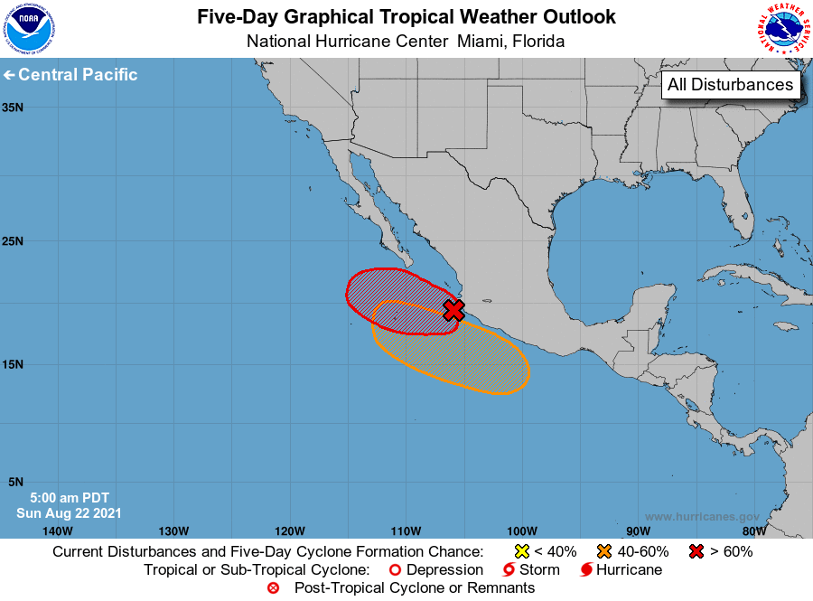
For the eastern North Pacific...east of 140 degrees west longitude:
1. A large area of disorganized showers and thunderstorms along and
offshore of the coast of west-central Mexico is associated with
the remnants of Grace. Environmental conditions are forecast to be
conducive for development, and a tropical depression is likely to
form within the next day or so while the system moves westward at
10 to 15 mph away from the coast of Mexico.
* Formation chance through 48 hours...high...80 percent.
* Formation chance through 5 days...high...80 percent.
2. An area of low pressure is forecast to form offshore of the coast of
southern Mexico early next week. Environmental conditions are
expected to be conducive for some gradual development thereafter,
and a tropical depression could form by mid-week. The system is
forecast to move generally west-northwestward at 10 to 15 mph, near
or just offshore of the southwestern coast of Mexico.
* Formation chance through 48 hours...low...near 0 percent.
* Formation chance through 5 days...medium...60 percent.
Forecaster Roberts