ZCZC MIATWOEP ALL
TTAA00 KNHC DDHHMM
Tropical Weather Outlook
NWS National Hurricane Center Miami FL
1100 PM PDT Mon Aug 9 2021
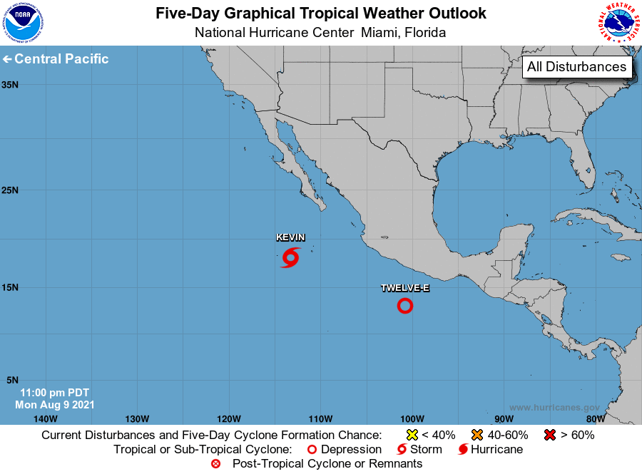
For the eastern North Pacific...east of 140 degrees west longitude:
The National Hurricane Center is issuing advisories on Tropical
Storm Kevin, located several hundred miles south-southwest of the
southern tip of the Baja California peninsula.
1. Recent satellite-derived wind data indicate that a large low
pressure system located about 300 miles south of Acapulco, Mexico,
has developed a well-defined center and is producing 30 to 35-mph
winds. Additionally, associated shower and thunderstorm activity is
showing increased signs of organization. Therefore, advisories will
likely be initiated on a tropical depression early this morning.
The low is forecast to move west-northwestward to westward at 10 to
15 mph through midweek, parallel to and well offshore of the coast
of southwestern Mexico.
* Formation chance through 48 hours...high...90 percent.
* Formation chance through 5 days...high...90 percent.
Forecaster Reinhart/Pasch