ZCZC MIATWOEP ALL
TTAA00 KNHC DDHHMM
Tropical Weather Outlook
NWS National Hurricane Center Miami FL
1100 PM PDT Fri Aug 6 2021
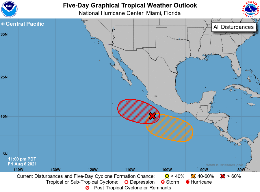
For the eastern North Pacific...east of 140 degrees west longitude:
1. Showers and thunderstorms associated with a broad area of low
pressure located a few hundred miles south of Manzanillo, Mexico,
continue to show signs of organization. Environmental conditions
are conducive for additional development, and a tropical depression
is expected to form over the weekend or early next week while
moving westward or west-northwestward at 5 to 10 mph.
* Formation chance through 48 hours...medium...60 percent.
* Formation chance through 5 days...high...90 percent.
2. An area of low pressure is expected to develop a few hundred miles
south of the Gulf of Tehuantepec by early next week. Environmental
conditions are forecast to be conducive for gradual development
thereafter, and a tropical depression could form by the middle of
next week while the system moves west-northwestward at about 10
mph, parallel to and offshore of the coast of southern Mexico.
* Formation chance through 48 hours...low...near 0 percent.
* Formation chance through 5 days...medium...40 percent.
Forecaster Berg