ZCZC MIATWOEP ALL
TTAA00 KNHC DDHHMM
Tropical Weather Outlook
NWS National Hurricane Center Miami FL
500 AM PDT Sun Aug 1 2021
For the eastern North Pacific...east of 140 degrees west longitude:
The National Hurricane Center is issuing advisories on Hurricane
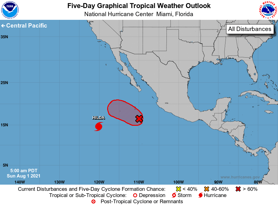
Hilda, located about 900 miles southwest of the southern tip of
the Baja California peninsula. The National Hurricane Center has
issued the last advisory on Post-Tropical Cyclone Nine-E, located
about 1400 miles west-southwest of the southern tip of the Baja
California peninsula.
1. Showers and a few thunderstorms persist near a low pressure system
located about 350 miles southwest of Manzanillo, Mexico. The low is
likely to become a tropical depression during the next day or so
while continuing to move west-northwestward at 10 to 15 mph, away
from the coast of Mexico. Development is not likely by late Monday
once the system begins moving over cooler waters.
* Formation chance through 48 hours...high...80 percent.
* Formation chance through 5 days...high...80 percent.
Forecaster Stewart