ZCZC MIATWOEP ALL
TTAA00 KNHC DDHHMM
Tropical Weather Outlook
NWS National Hurricane Center Miami FL
1100 PM PDT Sat Jul 24 2021
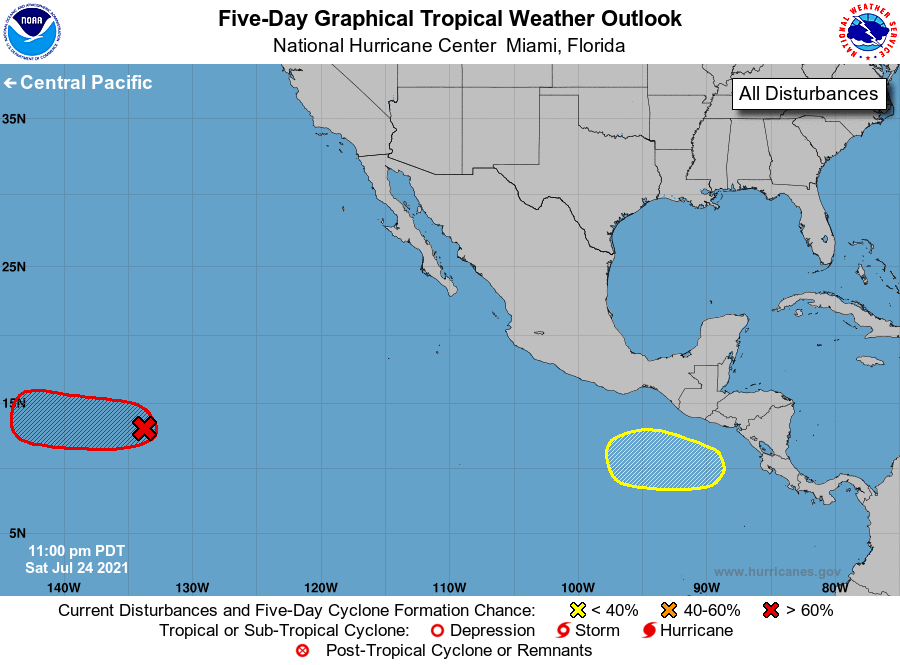
For the eastern North Pacific...east of 140 degrees west longitude:
1. A low pressure system located about 1500 miles east-southeast of
the Hawaiian Islands continues to show signs of organization.
Environmental conditions are forecast to be conducive for further
development, and the system could become a tropical depression later
this weekend or early next week before reaching cooler waters while
moving westward at 10 to 15 mph.
* Formation chance through 48 hours...high...70 percent.
* Formation chance through 5 days...high...70 percent.
2. An area of low pressure could form a few hundred miles south or
southeast of the Gulf of Tehuantepec in a few days. Some gradual
development is possible thereafter through the middle of next week
while the system moves generally parallel to, but offshore of, the
coast of southern Mexico.
* Formation chance through 48 hours...low...near 0 percent.
* Formation chance through 5 days...low...20 percent.
Forecaster Stewart