ZCZC MIATWOEP ALL
TTAA00 KNHC DDHHMM
Tropical Weather Outlook
NWS National Hurricane Center Miami FL
1100 AM PDT Sat Jul 24 2021
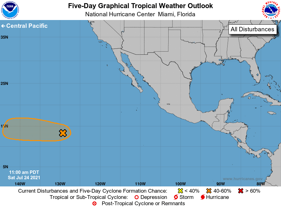
For the eastern North Pacific...east of 140 degrees west longitude:
1. A broad area of low pressure located more than 1400 miles
west-southwest of the southern tip of the Baja California peninsula
is producing a concentrated area of showers and thunderstorms. This
activity has become a bit better organized, but the system currently
lacks a well-defined low-level circulation. Environmental
conditions are forecast to be conducive for further development,
and this system could become a tropical depression later this
weekend or early next week before reaching cooler waters while
moving westward at 10 to 15 mph.
* Formation chance through 48 hours...medium...50 percent.
* Formation chance through 5 days...medium...60 percent.
Forecaster Papin/Beven