Skip Navigation Links
NOAA NOAA United States Department of Commerce

NHC Graphical Outlook Archive


« Earliest Available         ‹ Earlier         Later ›         Latest Available »
GIS Shapefiles
Central Pacific Eastern Pacific Atlantic

View 2-Day Graphical Tropical Weather Outlook
Click for Atlantic Click for Atlantic

Tropical Weather Outlook Text

ZCZC MIATWOEP ALL
TTAA00 KNHC DDHHMM

Tropical Weather Outlook
NWS National Hurricane Center Miami FL
1100 PM PDT Thu Jul 22 2021

For the eastern North Pacific...east of 140 degrees west longitude:

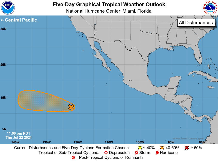
1. An area of disturbed weather located about 1150 miles southwest of 
the southern tip of the Baja California peninsula is still 
producing a large area of showers and thunderstorms. Environmental 
conditions are generally conducive for some development, and this 
system could become a tropical depression this weekend before it 
moves across cooler waters early next week while it heads westward 
to west-northwestward at 10-15 mph.
* Formation chance through 48 hours...low...30 percent. 
* Formation chance through 5 days...medium...40 percent.

Forecaster Blake


List of Atlantic Outlooks (May 2023 - present)
List of East Pacific Outlooks (May 2023 - present)
List of Central Pacific Outlooks (May 2023 - present)
List of Atlantic Outlooks (July 2014 - April 2023)
List of East Pacific Outlooks (July 2014 - April 2023)
List of Central Pacific Outlooks (June 2019 - April 2023)
List of Atlantic Outlooks (June 2009 - June 2014)
List of East Pacific Outlooks (June 2009 - June 2014)