ZCZC MIATWOEP ALL
TTAA00 KNHC DDHHMM
Tropical Weather Outlook
NWS National Hurricane Center Miami FL
1100 AM PDT Sun Jul 11 2021
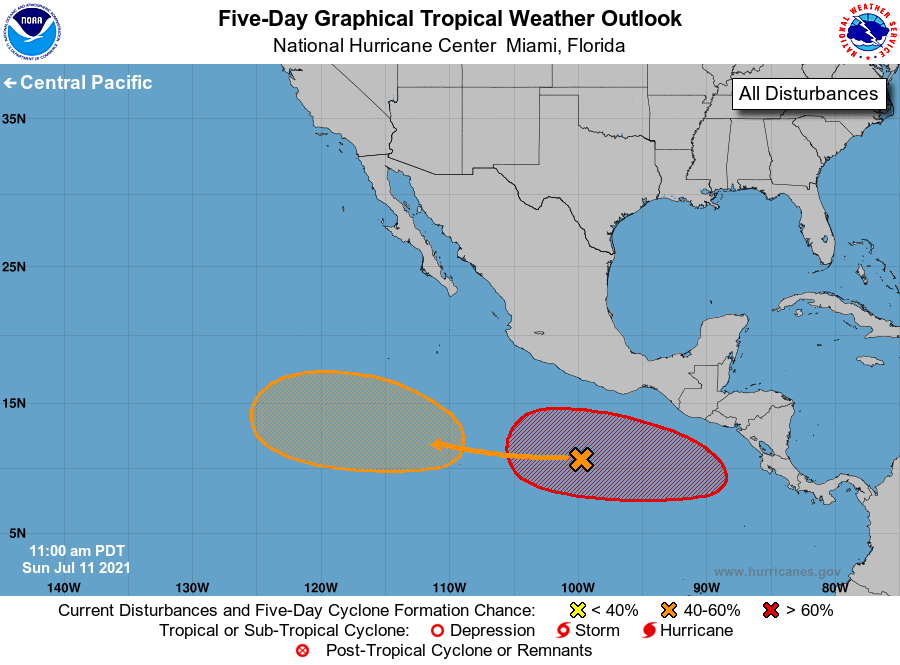
For the eastern North Pacific...east of 140 degrees west longitude:
1. Disorganized showers and thunderstorms located several hundred miles
south of Acapulco, Mexico, are associated with a tropical wave.
Environmental conditions are forecast to be conducive for gradual
development, and a tropical depression could form well offshore the
southwest coast of Mexico around midweek as the disturbance moves
generally westward at 10 to 15 mph.
* Formation chance through 48 hours...low...near 0 percent.
* Formation chance through 5 days...medium...50 percent.
2. An area of low pressure is forecast to develop southeast or south
of the Gulf of Tehuantepec around midweek and move generally
westward or west-northwestward at 10 to 15 mph, well offshore the
southern coast of Mexico. Environmental conditions are expected to
support the development of this system, and a tropical depression is
likely to form by late week.
* Formation chance through 48 hours...low...near 0 percent.
* Formation chance through 5 days...high...70 percent.
Forecaster Brown