ZCZC MIATWOEP ALL
TTAA00 KNHC DDHHMM
Tropical Weather Outlook
NWS National Hurricane Center Miami FL
500 AM PDT Thu Jun 24 2021
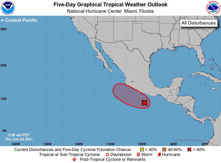
For the eastern North Pacific...east of 140 degrees west longitude:
1. Although showers and thunderstorms have increased in association
with an area of low pressure located a couple of hundred miles south
of southern Mexico, the circulation remains broad and elongated.
Environmental conditions are conducive for gradual development, and
a tropical depression is expected to form within the next couple of
days while the disturbance moves west-northwestward at about 10 mph.
This system is expected to be near the coast of southern or
southwestern Mexico through the weekend, and interests in those
areas should monitor its potential for development, as well as the
threat of heavy rainfall and flooding.
* Formation chance through 48 hours...high...80 percent.
* Formation chance through 5 days...high...90 percent.
Forecaster Cangialosi