ZCZC MIATWOEP ALL
TTAA00 KNHC DDHHMM
Tropical Weather Outlook
NWS National Hurricane Center Miami FL
1100 AM PDT Wed Jun 23 2021
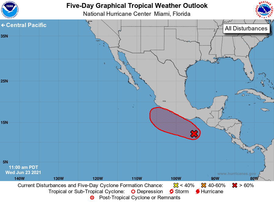
For the eastern North Pacific...east of 140 degrees west longitude:
1. Showers and thunderstorm have changed little in organization during
the past several hours in association with a broad area of low
pressure located a few hundred miles south of the Gulf of
Tehuantepec. Environmental conditions appear conducive for
development of this system, and a tropical depression is expected to
form during the next couple of days as the disturbance moves
west-northwestward at about 10 mph. This system is expected to be
near the coast of southern or southwestern Mexico this weekend, and
interests in those areas should monitor its progress for
development, and the threat of heavy rainfall and flooding.
* Formation chance through 48 hours...high...70 percent.
* Formation chance through 5 days...high...90 percent.
Forecaster Cangialosi