ZCZC MIATWOEP ALL
TTAA00 KNHC DDHHMM
Tropical Weather Outlook
NWS National Hurricane Center Miami FL
500 AM PDT Tue Jun 22 2021
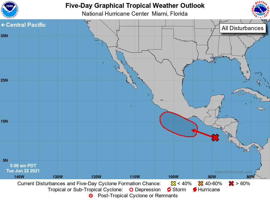
For the eastern North Pacific...east of 140 degrees west longitude:
1. A tropical wave located over Central America and the far eastern
portion of the eastern Pacific is producing a large area of
disorganized showers and thunderstorms. Environmental conditions
appear conducive for gradual development of this system, and a
tropical depression is likely to form by the end of the week or this
weekend. This disturbance is expected to move generally
west-northwestward, and could be near the coast of southern Mexico
by the weekend. Interests in southern Mexico should monitor the
progress of this system.
* Formation chance through 48 hours...low...10 percent.
* Formation chance through 5 days...high...80 percent.
Forecaster Cangialosi