ZCZC MIATWOEP ALL
TTAA00 KNHC DDHHMM
Tropical Weather Outlook
NWS National Hurricane Center Miami FL
1100 PM PDT Thu Jun 17 2021
For the eastern North Pacific...east of 140 degrees west longitude:
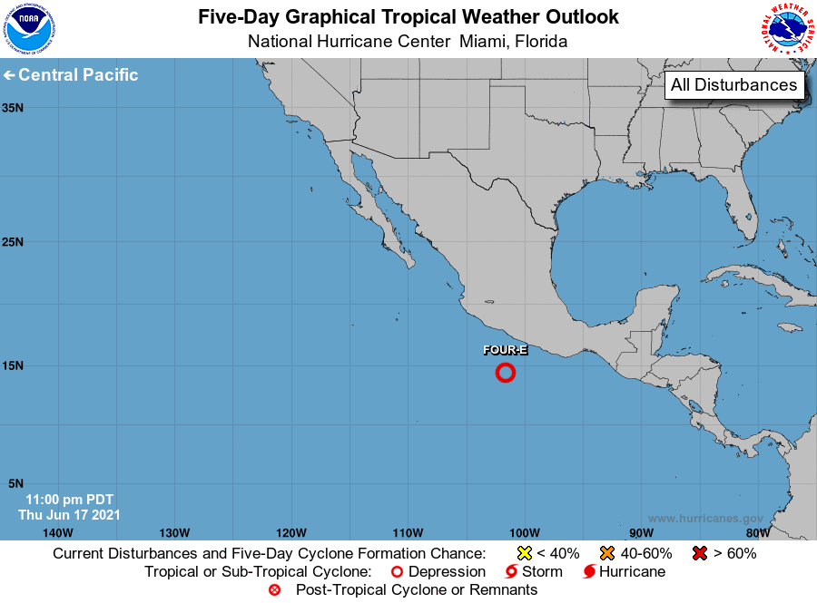
1. Recent satellite-derived winds indicate that the area of low
pressure located about a couple hundred miles south of Acapulco,
Mexico is becoming better defined. In addition, shower and
thunderstorm activity is gradually becoming better organized. A
tropical depression is expected to form later this morning while the
system moves west-northwestward at 5 to 10 mph. Regardless of
development, heavy rains are likely over coastal sections of the
Mexican states of Oaxaca, Guerrero, Michoacan, Colima, and Jalisco
during the next few days, which could cause life-threatening flash
floods and mudslides. Interests in these areas should monitor the
progress of this system through the weekend, and tropical storm
watches and warnings could be needed for a portion of the Mexican
coastline later today.
* Formation chance through 48 hours...high...near 100 percent.
* Formation chance through 5 days...high...near 100 percent.
Forecaster Papin/Blake