ZCZC MIATWOEP ALL
TTAA00 KNHC DDHHMM
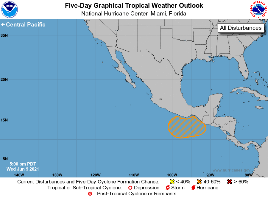
Tropical Weather Outlook
NWS National Hurricane Center Miami FL
500 PM PDT Wed Jun 9 2021
For the eastern North Pacific...east of 140 degrees west longitude:
1. A broad area of low pressure is expected to form a couple of hundred
miles south of the coasts of southern Mexico and Guatemala during
the next day or two. Environmental conditions appear favorable for
some gradual development thereafter, and a tropical depression could
form this weekend while the system drifts generally northward.
Regardless of development, heavy rainfall could occur over portions
of Central America and southern Mexico late this week and into the
weekend. See products from your local meteorological service for
more information.
* Formation chance through 48 hours...low...near 0 percent.
* Formation chance through 5 days...medium...40 percent.
Forecaster Papin/Stewart