ZCZC MIATWOEP ALL
TTAA00 KNHC DDHHMM
Tropical Weather Outlook
NWS National Hurricane Center Miami FL
1100 AM PDT Sun Jun 6 2021
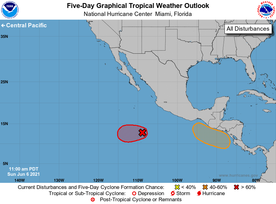
For the eastern North Pacific...east of 140 degrees west longitude:
1. Satellite imagery indicates that an area of low pressure located
several hundred miles south-southwest of Manzanillo, Mexico is
producing an organized area of showers and thunderstorms and could
be developing a better-defined surface circulation. This system
will likely become a tropical depression by tonight while it moves
slowly westward. Upper-level winds are expected to become less
favorable for additional development in a couple of days.
* Formation chance through 48 hours...high...90 percent.
* Formation chance through 5 days...high...90 percent.
2. A broad trough of low pressure is expected to form a couple of
hundred miles south of the coasts of southern Mexico, El Salvador,
and Guatemala in a few days. Environmental conditions appear
favorable for some development, and a tropical depression could
develop by the end of the week as the system moves slowly
northwestward or northward.
* Formation chance through 48 hours...low...near 0 percent.
* Formation chance through 5 days...medium...40 percent.
Forecaster Reinhart/Blake