Skip Navigation Links
NOAA NOAA United States Department of Commerce

NHC Graphical Outlook Archive


« Earliest Available         ‹ Earlier         Later ›         Latest Available »
GIS Shapefiles
Central Pacific Eastern Pacific Atlantic

View 2-Day Graphical Tropical Weather Outlook
Click for Atlantic Click for Atlantic

Tropical Weather Outlook Text

ZCZC MIATWOEP ALL
TTAA00 KNHC DDHHMM

Tropical Weather Outlook
NWS National Hurricane Center Miami FL
1100 AM PDT Fri Jun 4 2021

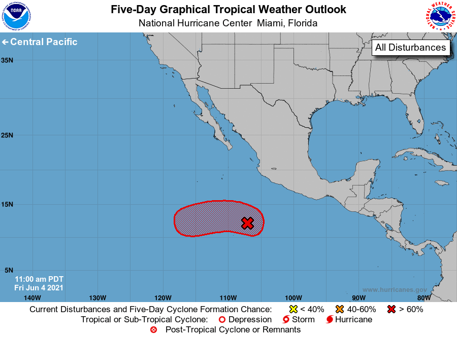
For the eastern North Pacific...east of 140 degrees west longitude:

1. An area of low pressure has developed within a larger-scale trough 
located several hundred miles south of Manzanillo, Mexico. Showers 
and thunderstorms associated with this system have become better 
organized today, and further development is now expected. A 
tropical depression is likely to form by early next week as it 
moves slowly to the west-northwest well off the coast of Mexico.
* Formation chance through 48 hours...medium...50 percent. 
* Formation chance through 5 days...high...70 percent.

Forecaster Papin/Blake


List of Atlantic Outlooks (May 2023 - present)
List of East Pacific Outlooks (May 2023 - present)
List of Central Pacific Outlooks (May 2023 - present)
List of Atlantic Outlooks (July 2014 - April 2023)
List of East Pacific Outlooks (July 2014 - April 2023)
List of Central Pacific Outlooks (June 2019 - April 2023)
List of Atlantic Outlooks (June 2009 - June 2014)
List of East Pacific Outlooks (June 2009 - June 2014)