ZCZC MIATWOEP ALL
TTAA00 KNHC DDHHMM
Tropical Weather Outlook
NWS National Hurricane Center Miami FL
500 PM PDT Sun May 30 2021
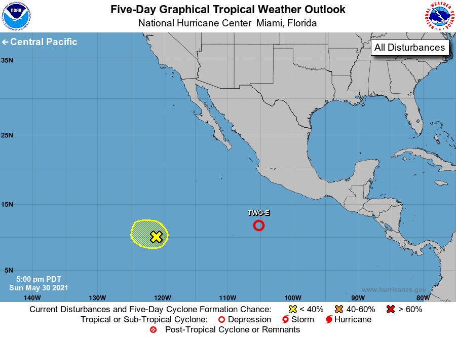
For the eastern North Pacific...east of 140 degrees west longitude:
The National Hurricane Center is issuing advisories on newly formed
Tropical Depression Two-E, located several hundred miles south of
Manzanillo, Mexico.
1. Shower and thunderstorm activity associated with a weak area of low
pressure located about 1200 miles southwest of the southern tip of
the Baja California peninsula is limited. The system is forecast to
move generally westward at 5 to 10 mph into a drier and more stable
airmass during the next couple of days with little, if any, further
development expected.
* Formation chance through 48 hours...low...10 percent.
* Formation chance through 5 days...low...10 percent.
Public Advisories on Tropical Depression Two-E are issued under WMO
header WTPZ32 KNHC and under AWIPS header MIATCPEP2.
Forecast/Advisories on Tropical Depression Two-E are issued under
WMO header WTPZ22 KNHC and under AWIPS header MIATCMEP2.
Forecaster Latto