ZCZC MIATWOEP ALL
TTAA00 KNHC DDHHMM
Tropical Weather Outlook
NWS National Hurricane Center Miami FL
500 AM PDT Fri May 28 2021
For the eastern North Pacific...east of 140 degrees west longitude:
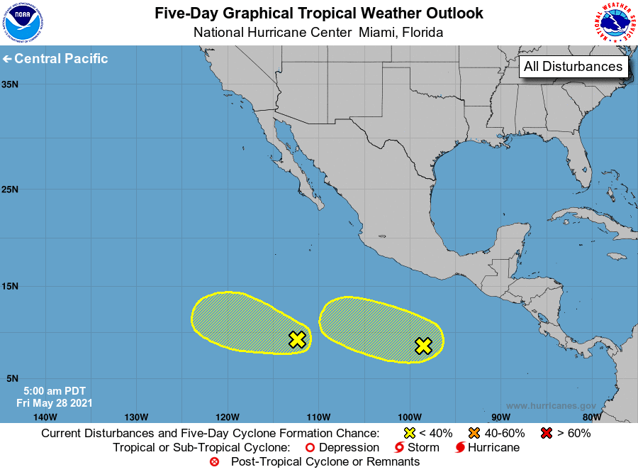
1. Shower activity has changed little in organization during the past
several hours in association with a broad area of low pressure
located about 950 miles south-southwest of the southern tip of the
Baja California peninsula. Some slow development of this system is
possible during the next few days while it moves westward
or west-northwestward at about 10 mph.
* Formation chance through 48 hours...low...20 percent.
* Formation chance through 5 days...low...30 percent.
2. A trough of low pressure is producing a large area of disorganized
showers and thunderstorms several hundred miles south of Acapulco,
Mexico. Some gradual development of this system is possible
during the next several days while it moves slowly westward or
west-northwestward.
* Formation chance through 48 hours...low...near 0 percent.
* Formation chance through 5 days...low...30 percent.
Forecaster Cangialosi