ZCZC MIATWOEP ALL
TTAA00 KNHC DDHHMM
Tropical Weather Outlook
NWS National Hurricane Center Miami FL
1100 PM PDT Thu May 27 2021
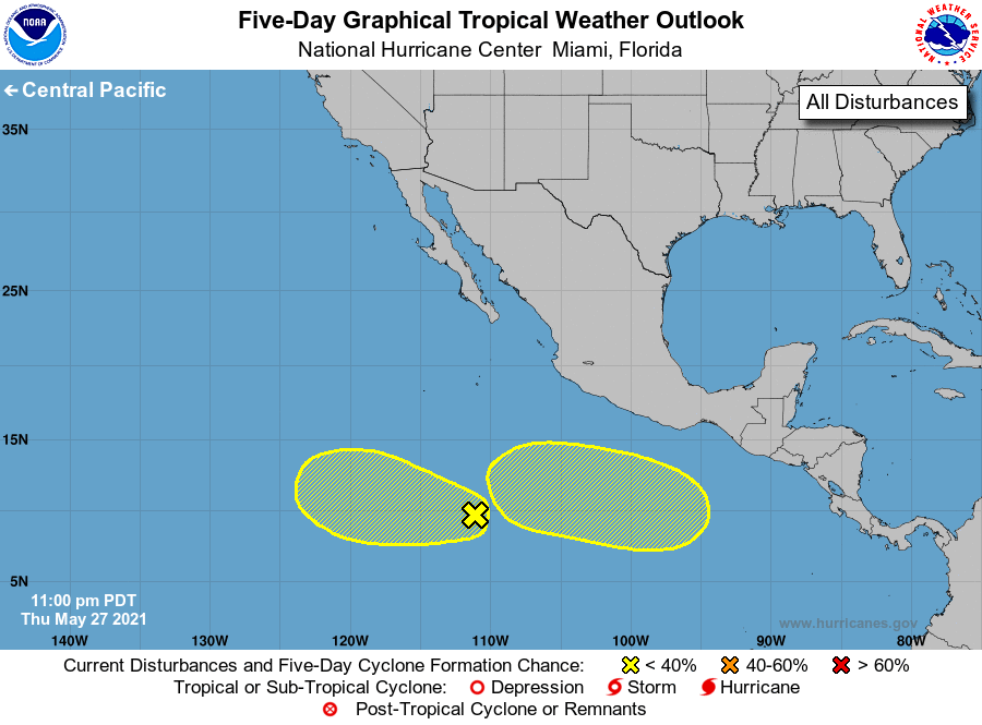
For the eastern North Pacific...east of 140 degrees west longitude:
1. Shower activity associated with a broad area of low pressure
located about 900 miles south of the southern tip of the Baja
California peninsula has become a little more concentrated since
yesterday. Some additional slow development could occur during
the next few days as the system moves westward or west-northwestward
at about 10 mph.
* Formation chance through 48 hours...low...20 percent.
* Formation chance through 5 days...low...30 percent.
2. Another area of low pressure is expected to form several hundred
miles south of the coast of southeastern Mexico during the next few
days. Some gradual development of this system is possible as it
moves generally westward at 5 to 10 mph.
* Formation chance through 48 hours...low...near 0 percent.
* Formation chance through 5 days...low...30 percent.
Forecaster Beven