ZCZC MIATWOEP ALL
TTAA00 KNHC DDHHMM
Tropical Weather Outlook
NWS National Hurricane Center Miami FL
1100 PM PDT Fri May 7 2021
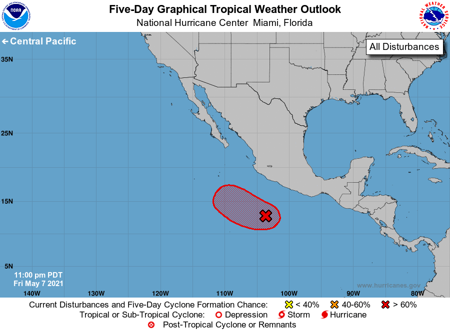
For the eastern North Pacific...east of 140 degrees west longitude:
Special Tropical Weather Outlook issued for an area of disturbed
weather southwest of Mexico.
1. Satellite images indicate that showers and thunderstorms associated
with the low pressure system located several hundred miles
southwest of the southern coast of Mexico continue to become better
organized. Further development of this system is expected over the
next couple of days and a short-lived tropical depression or
tropical storm is likely to form Saturday or on Sunday. By mid
next week, environmental conditions are expected to become less
favorable as the system moves gradually west-northwestward.
* Formation chance through 48 hours...high...70 percent.
* Formation chance through 5 days...high...70 percent.
The next Special Tropical Weather Outlook on this system will be
issued by 8 AM PDT Saturday, or earlier if conditions warrant.
Forecaster Roberts