Skip Navigation Links
NOAA NOAA United States Department of Commerce

NHC Graphical Outlook Archive


« Earliest Available         ‹ Earlier         Later ›         Latest Available »
GIS Shapefiles
Central Pacific Eastern Pacific Atlantic

View 2-Day Graphical Tropical Weather Outlook
Click for Atlantic Click for Atlantic

Tropical Weather Outlook Text

ZCZC MIATWOEP ALL
TTAA00 KNHC DDHHMM

Tropical Weather Outlook
NWS National Hurricane Center Miami FL
1000 AM PST Mon Nov 23 2020

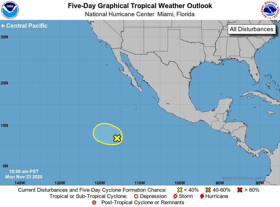
For the eastern North Pacific...east of 140 degrees west longitude:

1. Disorganized showers and thunderstorms continue in association with 
a trough of low pressure located about 800 miles south-southwest of 
the southern tip of the Baja California peninsula.  Development, if 
any, of this system should be slow to occur during the next day or 
so while it moves west-northwestward. By the middle of the week, 
environmental conditions are expected to become unfavorable for 
further development.
* Formation chance through 48 hours...low...10 percent.
* Formation chance through 5 days...low...10 percent.

Forecaster Cangialosi


List of Atlantic Outlooks (May 2023 - present)
List of East Pacific Outlooks (May 2023 - present)
List of Central Pacific Outlooks (May 2023 - present)
List of Atlantic Outlooks (July 2014 - April 2023)
List of East Pacific Outlooks (July 2014 - April 2023)
List of Central Pacific Outlooks (June 2019 - April 2023)
List of Atlantic Outlooks (June 2009 - June 2014)
List of East Pacific Outlooks (June 2009 - June 2014)