ZCZC MIATWOEP ALL
TTAA00 KNHC DDHHMM
Tropical Weather Outlook
NWS National Hurricane Center Miami FL
400 AM PST Sun Nov 15 2020
For the eastern North Pacific...east of 140 degrees west longitude:
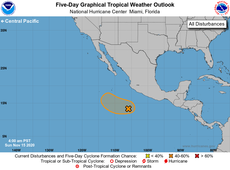
1. Shower and thunderstorm activity associated with a broad area of low
pressure located several hundred miles southwest of the coast of
southern Mexico has increased somewhat overnight. Although
environmental conditions are only marginally favorable, some slow
development of this system is possible, and a tropical depression
could form within a few days as the system moves slowly
west-northwestward or northwestward away from the coast of Mexico.
By mid week, conditions are expected to become unfavorable for
further development.
* Formation chance through 48 hours...low...30 percent.
* Formation chance through 5 days...medium...40 percent.
Forecaster Blake/Brown