ZCZC MIATWOEP ALL
TTAA00 KNHC DDHHMM
Tropical Weather Outlook
NWS National Hurricane Center Miami FL
500 AM PDT Tue Oct 13 2020
For the eastern North Pacific...east of 140 degrees west longitude:
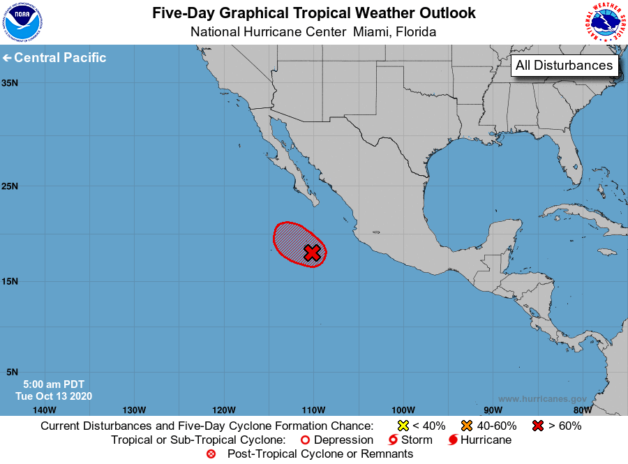
1. An area of low pressure, associated in part with the remnants of
Norbert, is located just southeast of Socorro Island, Mexico.
Satellite imagery indicates the low continues to produce showers
and thunderstorms near its center, and overnight satellite-derived
wind data revealed the low was becoming better organized. If this
development trend continues, a short-lived tropical depression could
form today or tonight while the low moves slowly west-northwestward.
However, environmental conditions are forecast to become less
conducive for development by Wednesday.
* Formation chance through 48 hours...high...70 percent.
* Formation chance through 5 days...high...70 percent.
Forecaster Reinhart/Cangialosi