ZCZC MIATWOEP ALL
TTAA00 KNHC DDHHMM
Tropical Weather Outlook
NWS National Hurricane Center Miami FL
500 AM PDT Mon Oct 12 2020
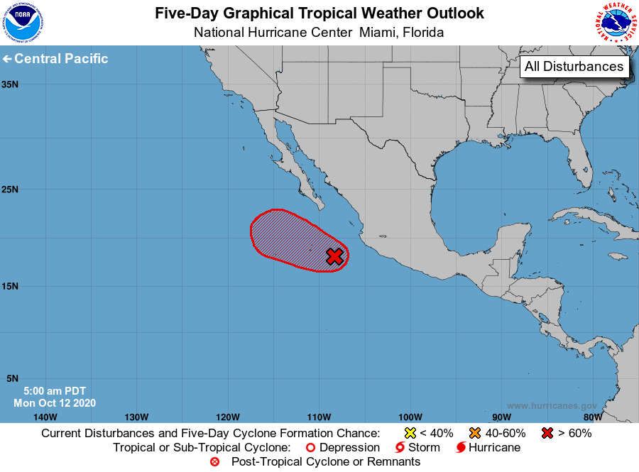
For the eastern North Pacific...east of 140 degrees west longitude:
1. An area of low pressure associated in part with the remnants of
Norbert is located a few hundred miles southwest of the southwestern
coast of Mexico. Although showers and thunderstorms continue to show
signs of organization, the surface circulation remains poorly
defined. However, environmental conditions are expected to
become more favorable for development during the next day or so,
and a tropical depression is likely to form within a few days while
the system moves slowly toward the west-northwest or northwest.
* Formation chance through 48 hours...medium...60 percent.
* Formation chance through 5 days...high...70 percent.
Forecaster Cangialosi