Skip Navigation Links
NOAA NOAA United States Department of Commerce

NHC Graphical Outlook Archive


« Earliest Available         ‹ Earlier         Later ›         Latest Available »
GIS Shapefiles
Central Pacific Eastern Pacific Atlantic

View 2-Day Graphical Tropical Weather Outlook
Click for Atlantic Click for Atlantic

Tropical Weather Outlook Text

ZCZC MIATWOEP ALL
TTAA00 KNHC DDHHMM

Tropical Weather Outlook
NWS National Hurricane Center Miami FL
1100 AM PDT Sun Oct 11 2020

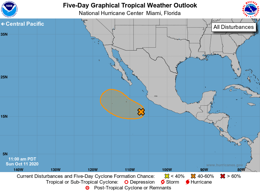
For the eastern North Pacific...east of 140 degrees west longitude:

1. Showers and thunderstorms, partially associated with the remnants 
of Norbert, are showing signs of organization a few hundred miles 
southwest of the coast of southwestern Mexico. Upper-level winds 
are forecast to become more conducive for development, and a 
tropical depression could form during the next few days while the 
system moves slowly to the west-northwest or northwest. 
* Formation chance through 48 hours...low...30 percent.
* Formation chance through 5 days...medium...50 percent.

Forecaster Blake


List of Atlantic Outlooks (May 2023 - present)
List of East Pacific Outlooks (May 2023 - present)
List of Central Pacific Outlooks (May 2023 - present)
List of Atlantic Outlooks (July 2014 - April 2023)
List of East Pacific Outlooks (July 2014 - April 2023)
List of Central Pacific Outlooks (June 2019 - April 2023)
List of Atlantic Outlooks (June 2009 - June 2014)
List of East Pacific Outlooks (June 2009 - June 2014)