ZCZC MIATWOEP ALL
TTAA00 KNHC DDHHMM
Tropical Weather Outlook
NWS National Hurricane Center Miami FL
1100 PM PDT Sat Oct 10 2020
For the eastern North Pacific...east of 140 degrees west longitude:
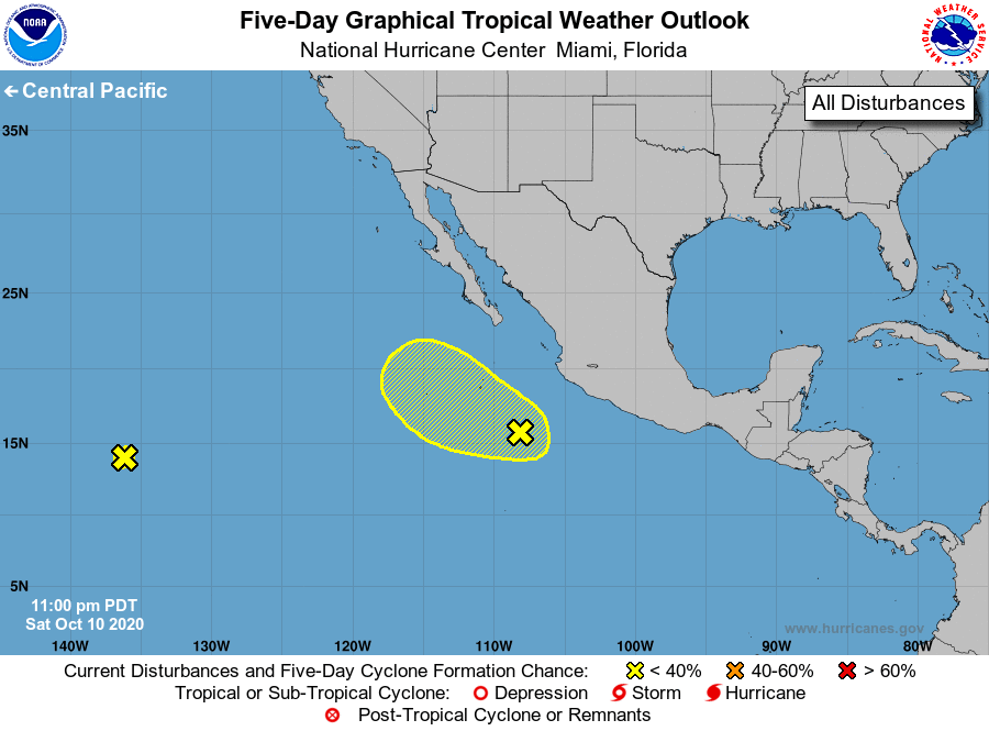
1. An elongated area of low pressure is producing a small area of
showers and thunderstorms nearly 1800 miles west-southwest of the
southern tip of the Baja California Peninsula. Further development
of this system is not anticipated. The low will likely continue
moving westward around 15 mph for the next few days.
* Formation chance through 48 hours...low...near 0 percent.
* Formation chance through 5 days...low...near 0 percent.
2. Disorganized showers and thunderstorms located several hundred miles
southwest of the coast of southwestern Mexico are associated in part
with the remnants of Norbert. This system is forecast to move very
little during the next couple of days, and then move slowly toward
the northwest after that. Some slight development is possible by the
middle of the week.
* Formation chance through 48 hours...low...10 percent.
* Formation chance through 5 days...low...30 percent.
Forecaster Zelinsky