ZCZC MIATWOEP ALL
TTAA00 KNHC DDHHMM
Tropical Weather Outlook
NWS National Hurricane Center Miami FL
1100 AM PDT Fri Oct 9 2020
For the eastern North Pacific...east of 140 degrees west longitude:
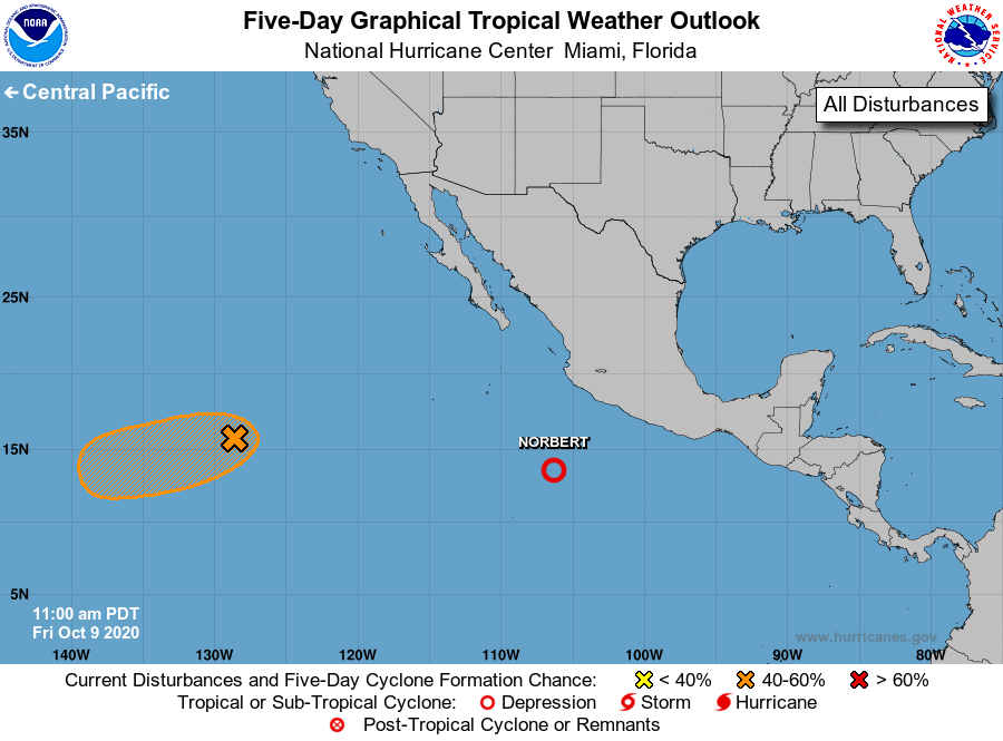
The National Hurricane Center is issuing advisories on Tropical
Depression Norbert, located several hundred miles south-southwest
of Manzanillo, Mexico.
1. A small, well-defined low pressure system is located about 1300
miles west-southwest of the southern tip of the Baja California
peninsula. Dry mid-level air is currently inhibiting shower and
thunderstorm activity. However, environmental conditions are
somewhat conducive for development, and if there is an increase in
shower and thunderstorm activity a tropical depression could still
form while the low moves toward the west or west-southwest at about
10 mph during the next few days.
* Formation chance through 48 hours...medium...40 percent.
* Formation chance through 5 days...medium...50 percent.
Forecaster Latto