ZCZC MIATWOEP ALL
TTAA00 KNHC DDHHMM
Tropical Weather Outlook
NWS National Hurricane Center Miami FL
500 AM PDT Mon Oct 5 2020
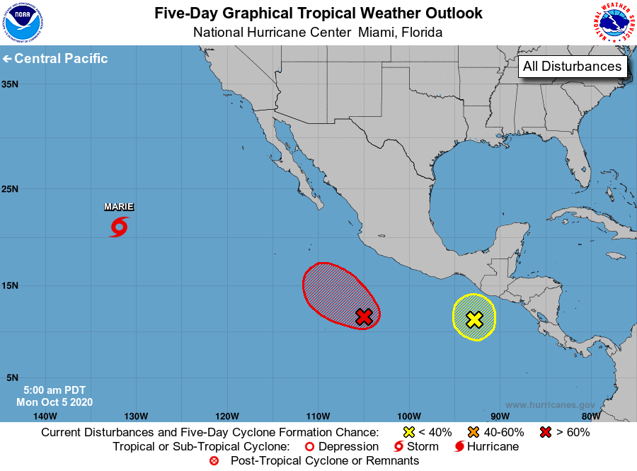
For the eastern North Pacific...east of 140 degrees west longitude:
The National Hurricane Center is issuing advisories on Tropical
Storm Marie, located over the western part of the basin.
1. Showers and thunderstorms continue in association with an area of
low pressure located several hundred miles south of the
southwestern coast of Mexico. Environmental conditions appear
conducive for additional development, and a tropical depression
will likely form during the next couple of days while the system
drifts northwestward.
* Formation chance through 48 hours...high...70 percent.
* Formation chance through 5 days...high...80 percent.
2. A broad area of low pressure is located a few hundred miles
south-southeast of the Gulf of Tehuantepec. Some slight
development of this system is possible over the next couple of
days while it moves slowly northward. Upper-level winds are
forecast to become unfavorable for development by Thursday.
* Formation chance through 48 hours...low...10 percent.
* Formation chance through 5 days...low...10 percent.
Forecaster Roberts