ZCZC MIATWOEP ALL
TTAA00 KNHC DDHHMM
Tropical Weather Outlook
NWS National Hurricane Center Miami FL
1100 AM PDT Sun Oct 4 2020
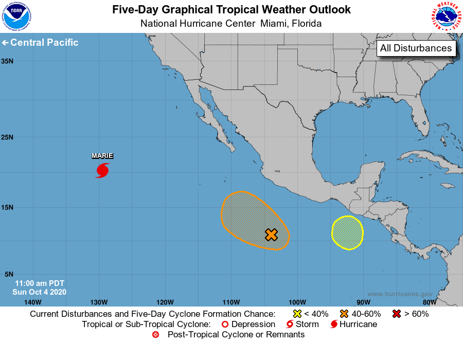
For the eastern North Pacific...east of 140 degrees west longitude:
The National Hurricane Center is issuing advisories on Hurricane
Marie, located in the western region of the basin.
1. Showers and thunderstorms have changed little since yesterday in
association with an elongated area of low pressure located several
hundred miles south of the southwestern coast of Mexico.
Environmental conditions appear conducive for additional
development, and a tropical depression could still form during the
next few days while it moves slowly northwestward.
* Formation chance through 48 hours...medium...40 percent.
* Formation chance through 5 days...medium...60 percent.
2. An area of low pressure could form south-southeast of the Gulf of
Tehuantepec early next week. Thereafter, development, if any,
should be slow to occur while it drifts northward offshore of the
coasts of Mexico and Guatemala.
* Formation chance through 48 hours...low...near 0 percent.
* Formation chance through 5 days...low...10 percent.
Forecaster Roberts