ZCZC MIATWOEP ALL
TTAA00 KNHC DDHHMM
Tropical Weather Outlook
NWS National Hurricane Center Miami FL
500 AM PDT Sat Oct 3 2020
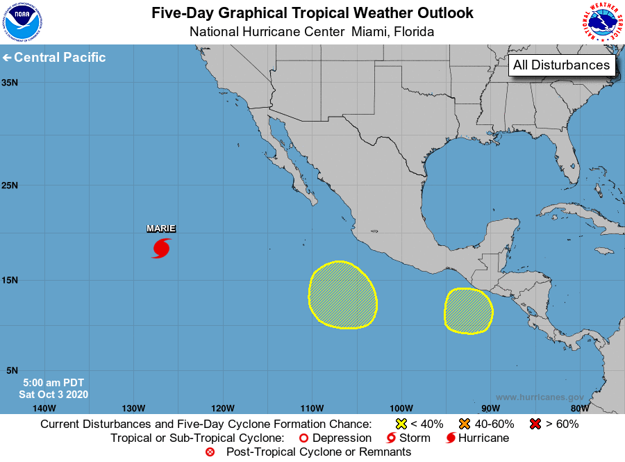
For the eastern North Pacific...east of 140 degrees west longitude:
The National Hurricane Center is issuing advisories on Hurricane
Marie, located about 1100 miles west-southwest of the southern tip
of the Baja California peninsula.
1. An area of low pressure is expected to form within the next couple
of days several hundred miles southwest of the coast of southwestern
Mexico. Some development of this system is possible through the
middle of next week while it moves slowly northwestward.
* Formation chance through 48 hours...low...near 0 percent.
* Formation chance through 5 days...low...20 percent.
2. Another area of low pressure could form south or southeast of the
Gulf of Tehuantepec early next week. Gradual development of this
system is possible thereafter while it drifts near or south of the
southern coasts of Mexico and Guatemala.
* Formation chance through 48 hours...low...near 0 percent.
* Formation chance through 5 days...low...20 percent.
Forecaster Reinhart/Berg