Skip Navigation Links
NOAA NOAA United States Department of Commerce

NHC Graphical Outlook Archive


« Earliest Available         ‹ Earlier         Later ›         Latest Available »
GIS Shapefiles
Central Pacific Eastern Pacific Atlantic

View 2-Day Graphical Tropical Weather Outlook
Click for Atlantic Click for Atlantic

Tropical Weather Outlook Text

ZCZC MIATWOEP ALL
TTAA00 KNHC DDHHMM

Tropical Weather Outlook
NWS National Hurricane Center Miami FL
1100 PM PDT Sat Sep 19 2020

For the eastern North Pacific...east of 140 degrees west longitude:

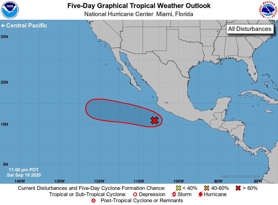
1. Showers and thunderstorms associated with a broad area of low 
pressure located a couple of hundred miles south-southwest of 
Manzanillo, Mexico, are showing signs of organization. 
Environmental conditions are forecast to be conducive for additional 
development, and a tropical depression is expected to form early 
next week while the system moves west-northwestward at about 10 mph, 
away from the coast of Mexico.
* Formation chance through 48 hours...high...70 percent.
* Formation chance through 5 days...high...90 percent.

Forecaster Cangialosi


List of Atlantic Outlooks (May 2023 - present)
List of East Pacific Outlooks (May 2023 - present)
List of Central Pacific Outlooks (May 2023 - present)
List of Atlantic Outlooks (July 2014 - April 2023)
List of East Pacific Outlooks (July 2014 - April 2023)
List of Central Pacific Outlooks (June 2019 - April 2023)
List of Atlantic Outlooks (June 2009 - June 2014)
List of East Pacific Outlooks (June 2009 - June 2014)