ZCZC MIATWOEP ALL
TTAA00 KNHC DDHHMM
Tropical Weather Outlook
NWS National Hurricane Center Miami FL
1100 PM PDT Wed Sep 9 2020
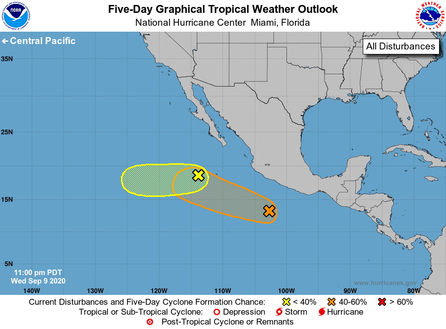
For the eastern North Pacific...east of 140 degrees west longitude:
1. An elongated area of low pressure located about 400 miles southwest
of the southern tip of the Baja California peninsula is producing
limited shower activity. Environmental conditions are expected to
be only marginally conducive for some development of this system
during the next several days while it moves slowly westward.
* Formation chance through 48 hours...low...10 percent.
* Formation chance through 5 days...low...20 percent.
2. A broad area of low pressure has formed about 350 miles
south-southwest of the coast of southwest Mexico and is producing a
large area of showers and thunderstorms. Gradual development of
this system is possible through this weekend and into early next
week while it moves west-northwestward away from the coast of
Mexico.
* Formation chance through 48 hours...low...20 percent.
* Formation chance through 5 days...medium...40 percent.
Forecaster Roberts