ZCZC MIATWOEP ALL
TTAA00 KNHC DDHHMM
Tropical Weather Outlook
NWS National Hurricane Center Miami FL
500 AM PDT Mon Sep 7 2020
For the eastern North Pacific...east of 140 degrees west longitude:
The National Hurricane Center has issued its last advisory on
Julio, which dissipated a few hundred miles southwest of the
southern tip of the Baja California peninsula.
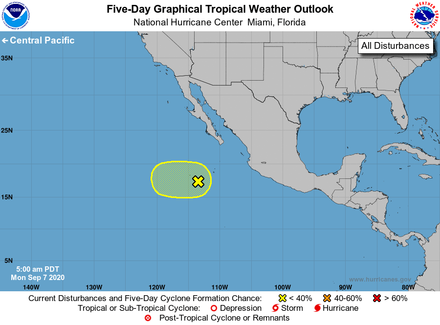
1. The remnants of Julio and a broader trough of low pressure are
expected to merge during the next day or two, and the resulting low
is forecast drift westward through the end of the week. Little or no
development of this system is expected for the next day or so due to
strong upper-level winds. Environmental conditions are expected to
become less hostile by Wednesday and some slight development is
possible thereafter.
* Formation chance through 48 hours...low...10 percent.
* Formation chance through 5 days...low...20 percent.
Forecaster Zelinsky