Skip Navigation Links
NOAA NOAA United States Department of Commerce

NHC Graphical Outlook Archive


« Earliest Available         ‹ Earlier         Later ›         Latest Available »
GIS Shapefiles
Central Pacific Eastern Pacific Atlantic

View 2-Day Graphical Tropical Weather Outlook
Click for Atlantic Click for Atlantic

Tropical Weather Outlook Text

ZCZC MIATWOEP ALL
TTAA00 KNHC DDHHMM

Tropical Weather Outlook
NWS National Hurricane Center Miami FL
500 AM PDT Fri Sep 4 2020

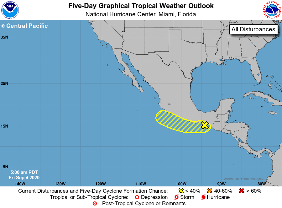
For the eastern North Pacific...east of 140 degrees west longitude:

1. Showers and thunderstorms associated with the remnants of Atlantic 
basin Tropical Depression Nana have increased over the Gulf of 
Tehuantepec during the past several hours. Some slight development 
is possible during the next day or two while the system moves 
generally west-northwestward, near or along the southern coast of 
Mexico. Unfavorable upper-level winds and proximity to land should 
inhibit further development by late this weekend.
* Formation chance through 48 hours...low...30 percent. 
* Formation chance through 5 days...low...30 percent.

Forecaster Zelinsky


List of Atlantic Outlooks (May 2023 - present)
List of East Pacific Outlooks (May 2023 - present)
List of Central Pacific Outlooks (May 2023 - present)
List of Atlantic Outlooks (July 2014 - April 2023)
List of East Pacific Outlooks (July 2014 - April 2023)
List of Central Pacific Outlooks (June 2019 - April 2023)
List of Atlantic Outlooks (June 2009 - June 2014)
List of East Pacific Outlooks (June 2009 - June 2014)