Skip Navigation Links
NOAA NOAA United States Department of Commerce

NHC Graphical Outlook Archive


« Earliest Available         ‹ Earlier         Later ›         Latest Available »
GIS Shapefiles
Central Pacific Eastern Pacific Atlantic

View 2-Day Graphical Tropical Weather Outlook
Click for Atlantic Click for Atlantic

Tropical Weather Outlook Text

ZCZC MIATWOEP ALL
TTAA00 KNHC DDHHMM

Tropical Weather Outlook
NWS National Hurricane Center Miami FL
1100 AM PDT Thu Sep 3 2020

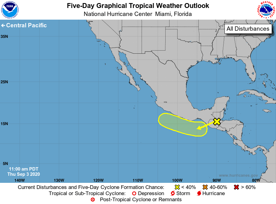
For the eastern North Pacific...east of 140 degrees west longitude:

1. The remnants of Atlantic basin Tropical Storm Nana, are expected to 
emerge over the extreme eastern Pacific waters near the Gulf of 
Tehuantepec on Friday.  Unfavorable upper-level winds are expected 
to inhibit significant development through early next week while 
the system moves generally west-northwestward, near or along the 
southern coast of Mexico. 
* Formation chance through 48 hours...low...10 percent. 
* Formation chance through 5 days...low...20 percent.

Forecaster Roberts


List of Atlantic Outlooks (May 2023 - present)
List of East Pacific Outlooks (May 2023 - present)
List of Central Pacific Outlooks (May 2023 - present)
List of Atlantic Outlooks (July 2014 - April 2023)
List of East Pacific Outlooks (July 2014 - April 2023)
List of Central Pacific Outlooks (June 2019 - April 2023)
List of Atlantic Outlooks (June 2009 - June 2014)
List of East Pacific Outlooks (June 2009 - June 2014)