ZCZC MIATWOEP ALL
TTAA00 KNHC DDHHMM
Tropical Weather Outlook
NWS National Hurricane Center Miami FL
500 PM PDT Mon Aug 17 2020
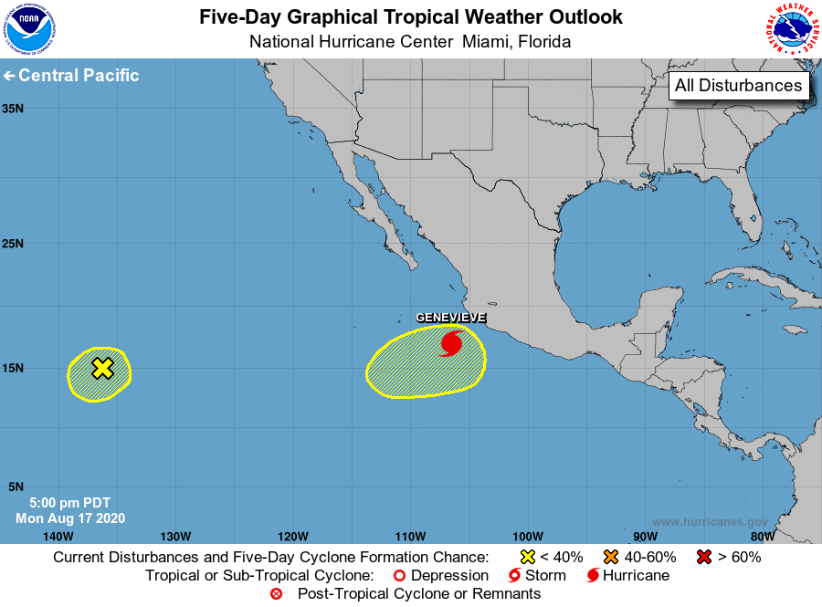
For the eastern North Pacific...east of 140 degrees west longitude:
The National Hurricane Center is issuing advisories on Hurricane
Genevieve, located several hundred miles southeast of the southern
tip of the Baja California peninsula.
1. A small area of showers and thunderstorms over the far southwestern
portion of the basin are associated with the remnant low of Tropical
Depression Ten-E. Environmental conditions do not appear conducive
for significant development, and regeneration of this system is not
anticipated while it moves slowly westward.
* Formation chance through 48 hours...low...10 percent.
* Formation chance through 5 days...low...10 percent.
2. An area of low pressure is expected to form later this week several
hundred miles west of the southwestern coast of Mexico. Conditions
appear favorable for some development of this system while it
meanders over the weekend.
* Formation chance through 48 hours...low...near 0 percent.
* Formation chance through 5 days...low...20 percent.
Forecaster Stewart