ZCZC MIATWOEP ALL
TTAA00 KNHC DDHHMM
Tropical Weather Outlook
NWS National Hurricane Center Miami FL
500 PM PDT Sun Aug 9 2020
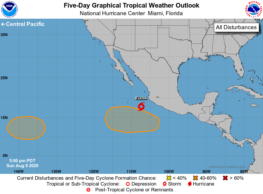
For the eastern North Pacific...east of 140 degrees west longitude:
The National Hurricane Center is issuing advisories on Tropical
Storm Elida, located a couple of hundred miles south of the
southwest coast of Mexico.
1. An area of low pressure will likely form over the far western
portion of the eastern Pacific basin in a few days. Environmental
conditions are expected to be generally conducive for gradual
development, and a tropical depression could form late this week
while the system moves slowly westward toward the central Pacific
basin.
* Formation chance through 48 hours...low...near 0 percent.
* Formation chance through 5 days...medium...40 percent.
2. Another area of low pressure is expected to form well offshore of
the southwestern coast of Mexico by the middle of the week.
Gradual development is possible thereafter, and this system could
also become a tropical depression late this week while it moves
generally west-northwestward.
* Formation chance through 48 hours...low...near 0 percent.
* Formation chance through 5 days...medium...40 percent.
Forecaster Pasch