Skip Navigation Links
NOAA NOAA United States Department of Commerce

NHC Graphical Outlook Archive


« Earliest Available         ‹ Earlier         Later ›         Latest Available »
GIS Shapefiles
Central Pacific Eastern Pacific Atlantic

View 2-Day Graphical Tropical Weather Outlook
Click for Atlantic Click for Atlantic

Tropical Weather Outlook Text

ZCZC MIATWOEP ALL
TTAA00 KNHC DDHHMM

Tropical Weather Outlook
NWS National Hurricane Center Miami FL
1100 AM PDT Fri Aug 7 2020

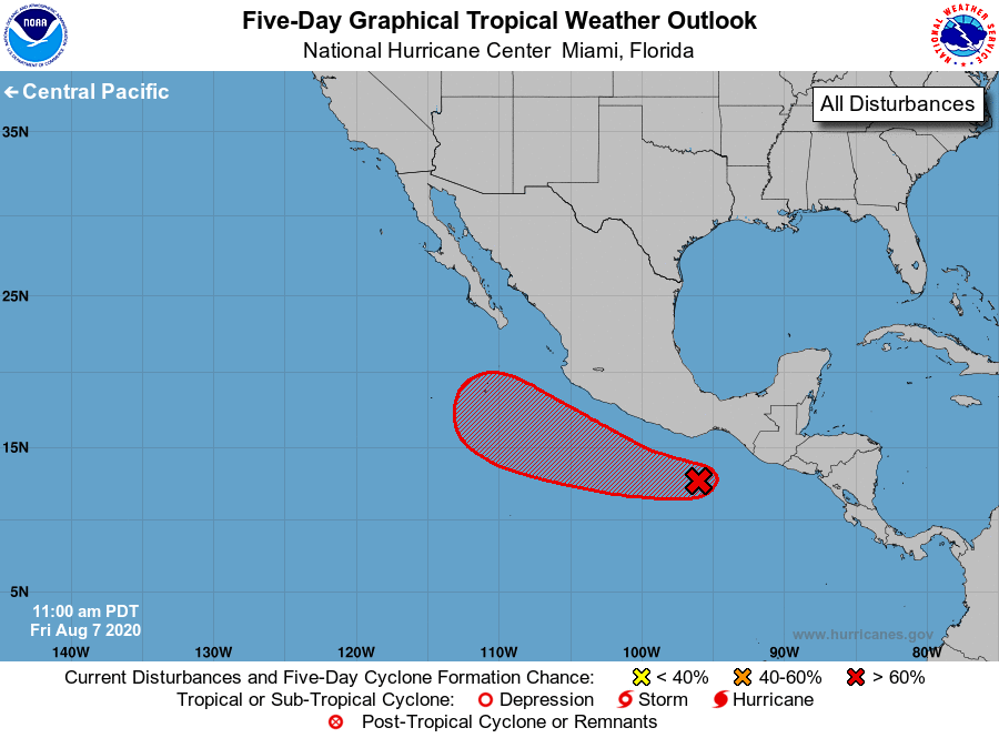
For the eastern North Pacific...east of 140 degrees west longitude:

1. Satellite images indicate that a broad area of low pressure is 
forming from a tropical wave centered a couple of hundred miles 
south-southwest of the Gulf of Tehuantepec.  Environmental 
conditions are forecast to be conducive for further development, 
and a tropical depression is expected to form in 2 or 3 days while 
the system moves generally west-northwestward, offshore of 
southwestern Mexico.
* Formation chance through 48 hours...medium...40 percent.
* Formation chance through 5 days...high...90 percent.

Forecaster Blake


List of Atlantic Outlooks (May 2023 - present)
List of East Pacific Outlooks (May 2023 - present)
List of Central Pacific Outlooks (May 2023 - present)
List of Atlantic Outlooks (July 2014 - April 2023)
List of East Pacific Outlooks (July 2014 - April 2023)
List of Central Pacific Outlooks (June 2019 - April 2023)
List of Atlantic Outlooks (June 2009 - June 2014)
List of East Pacific Outlooks (June 2009 - June 2014)