Skip Navigation Links
NOAA NOAA United States Department of Commerce

NHC Graphical Outlook Archive


« Earliest Available         ‹ Earlier         Later ›         Latest Available »
GIS Shapefiles
Central Pacific Eastern Pacific Atlantic

View 2-Day Graphical Tropical Weather Outlook
Click for Atlantic Click for Atlantic

Tropical Weather Outlook Text

ZCZC MIATWOEP ALL
TTAA00 KNHC DDHHMM

Tropical Weather Outlook
NWS National Hurricane Center Miami FL
1100 PM PDT Sat Jul 18 2020

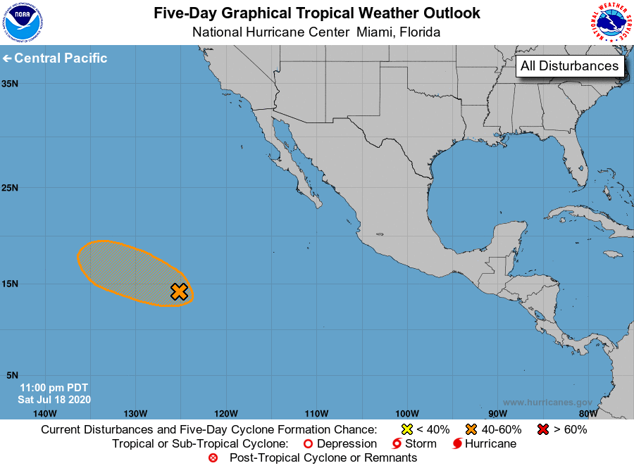
For the eastern North Pacific...east of 140 degrees west longitude:

1. A tropical wave accompanied by a surface low pressure system is 
located about 1100 miles southwest of the southern tip of the Baja 
California peninsula.  Shower and thunderstorm activity has become 
better organized over the past several hours, and environmental 
conditions are conducive for a tropical depression to form during 
the next day or so while the system moves west-northwestward.
* Formation chance through 48 hours...medium...60 percent.
* Formation chance through 5 days...medium...60 percent.

Forecaster Stewart


List of Atlantic Outlooks (May 2023 - present)
List of East Pacific Outlooks (May 2023 - present)
List of Central Pacific Outlooks (May 2023 - present)
List of Atlantic Outlooks (July 2014 - April 2023)
List of East Pacific Outlooks (July 2014 - April 2023)
List of Central Pacific Outlooks (June 2019 - April 2023)
List of Atlantic Outlooks (June 2009 - June 2014)
List of East Pacific Outlooks (June 2009 - June 2014)