ZCZC MIATWOEP ALL
TTAA00 KNHC DDHHMM
Tropical Weather Outlook
NWS National Hurricane Center Miami FL
500 AM PDT Mon Jul 13 2020
For the eastern North Pacific...east of 140 degrees west longitude:
The National Hurricane Center has issued the last advisory on
Post-Tropical Cyclone Cristina, located over 1000 miles west of
the southern tip of the Baja California peninsula.
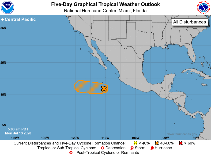
1. Thunderstorm activity has increased and become a little concentrated
overnight in association with a small low pressure area located less
than 200 miles south-southeast of Socorro Island, Mexico.
Environmental conditions are forecast to gradually become more
conducive for development, and this system still has the potential
to become a tropical depression during the next day or so while it
moves generally westward at about 20 mph. However, conditions are
expected to become less favorable for tropical cyclone development
by Wednesday night.
* Formation chance through 48 hours...medium...60 percent.
* Formation chance through 5 days...medium...60 percent.
Forecaster Stewart