ZCZC MIATWOEP ALL
TTAA00 KNHC DDHHMM
Tropical Weather Outlook
NWS National Hurricane Center Miami FL
500 AM PDT Sun Jul 12 2020
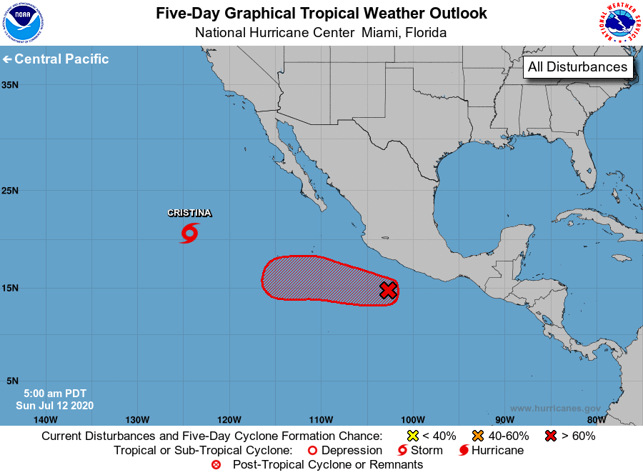
For the eastern North Pacific...east of 140 degrees west longitude:
The National Hurricane Center is issuing advisories on Tropical
Storm Cristina, located several hundred miles west of the southern
tip of the Baja California peninsula.
1. A small low pressure system located a couple of hundred miles south
of Lazaro Cardenas, Mexico, continues to produce disorganized shower
and thunderstorm activity. Although upper-level winds are currently
only marginally conducive for the development of a tropical cyclone,
environmental conditions are likely to become more favorable for the
formation of a tropical depression during the next couple of days
while the system moves quickly west-northwestward to westward, well
south of the coast of Mexico.
* Formation chance through 48 hours...medium...40 percent.
* Formation chance through 5 days...high...70 percent.
Forecaster Stewart