ZCZC MIATWOEP ALL
TTAA00 KNHC DDHHMM
Tropical Weather Outlook
NWS National Hurricane Center Miami FL
1100 PM PDT Sat Jul 11 2020
For the eastern North Pacific...east of 140 degrees west longitude:
The National Hurricane Center is issuing advisories on Tropical
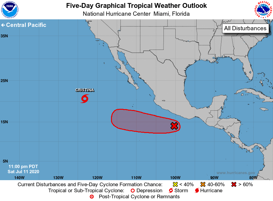
Storm Cristina, located several hundred miles west of the southern
tip of the Baja California peninsula.
1. A low pressure area located a couple of hundred miles south of
Acapulco, Mexico, is producing disorganized shower and thunderstorm
activity. Although upper-level winds are currently only marginally
conducive for the development of a tropical cyclone, environmental
conditions are likely to become more favorable for the formation
of a tropical depression in two or three days while the system
moves quickly west-northwestward to westward, well south of the
coast of Mexico.
* Formation chance through 48 hours...medium...40 percent.
* Formation chance through 5 days...high...70 percent.
Forecaster Blake