ZCZC MIATWOEP ALL
TTAA00 KNHC DDHHMM
Tropical Weather Outlook
NWS National Hurricane Center Miami FL
500 PM PDT Wed Jul 8 2020
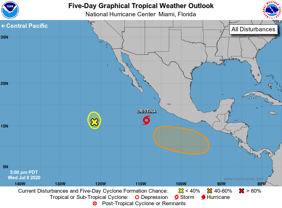
For the eastern North Pacific...east of 140 degrees west longitude:
The National Hurricane Center is issuing advisories on Tropical
Storm Cristina, located a few hundred miles southwest of
Manzanillo, Mexico.
1. A broad area of low pressure located about 900 miles southwest of
the southern tip of the Baja California peninsula has become much
less organized since yesterday. Development, if any, of this nearly
stationary low will be slow to occur during the next two days before
environmental conditions become unfavorable.
* Formation chance through 48 hours...low...10 percent.
* Formation chance through 5 days...low...10 percent.
2. An area of low pressure is forecast to form south of the Gulf of
Tehuantepec late this week. Environmental conditions are expected
to be conducive for development, and a tropical depression could
form early next week while the system moves westward well south of
the coast of Mexico.
* Formation chance through 48 hours...low...near 0 percent.
* Formation chance through 5 days...medium...50 percent.
Forecaster Blake