ZCZC MIATWOEP ALL
TTAA00 KNHC DDHHMM
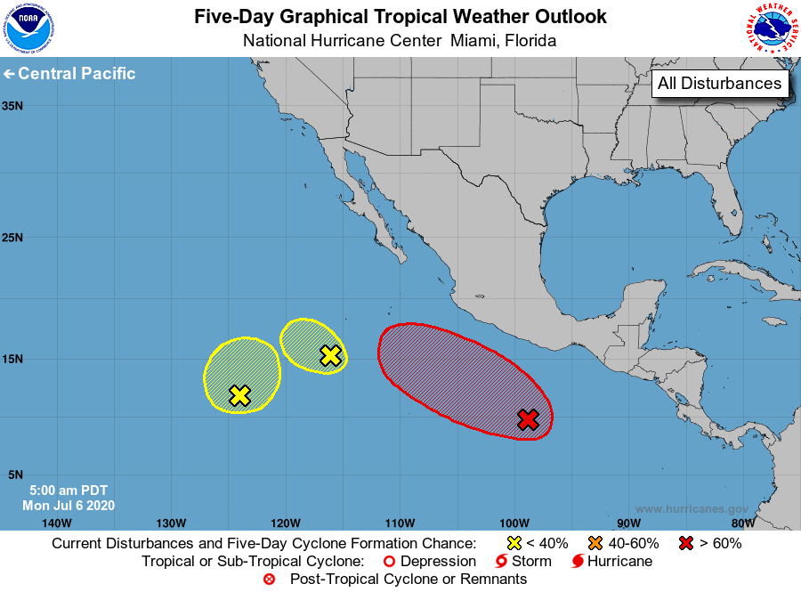
Tropical Weather Outlook
NWS National Hurricane Center Miami FL
500 AM PDT Mon Jul 6 2020
For the eastern North Pacific...east of 140 degrees west longitude:
1. Shower and thunderstorm activity associated with a broad area of low
pressure located several hundred miles south-southeast of Acapulco,
Mexico, have increased in coverage overnight. Environmental
conditions are expected to be conducive for development over the
next several days, and a tropical depression is likely to form
within the next two or three days while the system moves
west-northwestward, well south of the coast of southern Mexico.
* Formation chance through 48 hours...medium...60 percent.
* Formation chance through 5 days...high...90 percent.
2. An elongated area of low pressure located several hundred miles
southwest of the southern tip of the Baja California peninsula
continues to produce disorganized showers and a few thunderstorms.
Environmental conditions are becoming less conducive and
development, if any, of this system should be slow to occur during
the next day or two while it moves slowly westward. After that
time, further development of this system is not expected.
* Formation chance through 48 hours...low...10 percent.
* Formation chance through 5 days...low...10 percent.
3. Disorganized showers and thunderstorms located more than 1000 miles
southwest of the southern tip of the Baja California peninsula are
associated with a broad area of low pressure. Some gradual
development of this system is possible over the next several days
while it moves little.
* Formation chance through 48 hours...low...10 percent.
* Formation chance through 5 days...low...20 percent.
Forecaster Brown