ZCZC MIATWOEP ALL
TTAA00 KNHC DDHHMM
Tropical Weather Outlook
NWS National Hurricane Center Miami FL
1100 AM PDT Sun Jul 5 2020
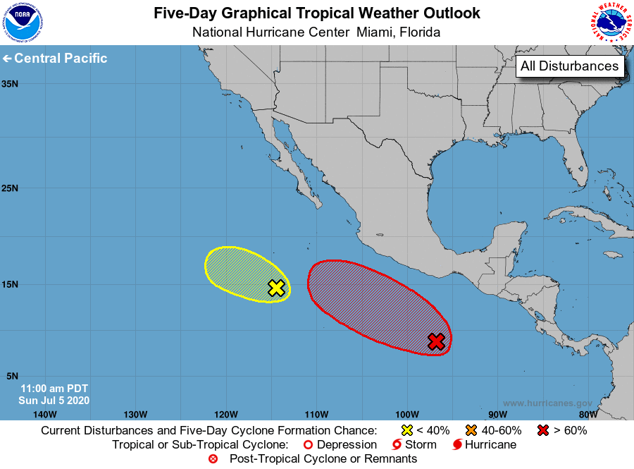
For the eastern North Pacific...east of 140 degrees west longitude:
1. An elongated area of low pressure located several hundred miles
south-southwest of the southern tip of the Baja California
peninsula continues to produce a large area of showers and
thunderstorms. The thunderstorm activity has become less
concentrated since yesterday, and any development of this system
should be slow to occur over the next couple of days while it moves
slowly west-northwestward.
* Formation chance through 48 hours...low...20 percent.
* Formation chance through 5 days...low...20 percent.
2. A broad area of low pressure has formed several hundred miles
south-southwest of the Gulf of Tehuantepec. Environmental
conditions are expected to be conducive for development over the
next several days, and a tropical depression is likely to form by
the middle of the week while the system moves west-northwestward,
well south of the coast of southern Mexico.
* Formation chance through 48 hours...medium...40 percent.
* Formation chance through 5 days...high...80 percent.
Forecaster Brown