ZCZC MIATWOEP ALL
TTAA00 KNHC DDHHMM
Tropical Weather Outlook
NWS National Hurricane Center Miami FL
500 AM PDT Fri Jul 3 2020
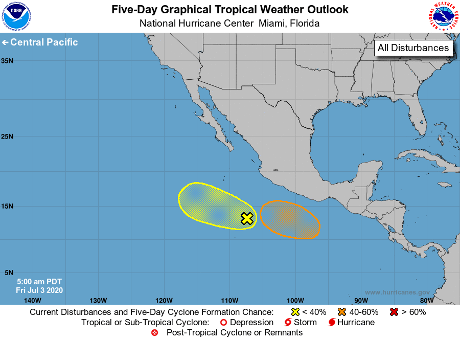
For the eastern North Pacific...east of 140 degrees west longitude:
1. Disorganized showers and a few thunderstorms continue in
association with a broad area of low pressure located several
hundred miles south of Manzanillo, Mexico. Some gradual development
of this system is possible through early next week while it moves
west-northwestward at around 10 mph.
* Formation chance through 48 hours...low...20 percent.
* Formation chance through 5 days...low...30 percent.
2. An area of low pressure is forecast to form south of the coast of
southern Mexico in a couple of days. Environmental conditions are
expected to be conducive for gradual development of the system
during the early and middle portions of next week while it moves
west-northwestward, well south of the coast of southern Mexico.
* Formation chance through 48 hours...low...near 0 percent.
* Formation chance through 5 days...medium...40 percent.
Forecaster Cangialosi