ZCZC MIATWOEP ALL
TTAA00 KNHC DDHHMM
Tropical Weather Outlook
NWS National Hurricane Center Miami FL
500 PM PDT Mon Jun 29 2020
For the eastern North Pacific...east of 140 degrees west longitude:
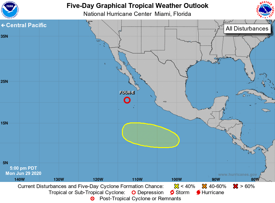
1. Showers and thunderstorms associated with an area of low pressure
located a couple of hundred miles southwest of the southern tip of
the Baja California peninsula have become slightly less organized
since late this morning. This system, however, could still become
a short-lived tropical depression later today or tonight before it
moves over cooler waters and into an area of less favorable
upper-level winds on Tuesday.
* Formation chance through 48 hours...medium...60 percent.
* Formation chance through 5 days...medium...60 percent.
2. An area of low pressure is forecast to form a few hundred miles
south of the coast of Mexico later this week. Gradual development
of the system will be possible by the weekend while it moves
west-northwestward at 10 to 15 mph well south of Mexico.
* Formation chance through 48 hours...low...near 0 percent.
* Formation chance through 5 days...low...20 percent.
Forecaster Brown