ZCZC MIATWOEP ALL
TTAA00 KNHC DDHHMM
Tropical Weather Outlook
NWS National Hurricane Center Miami FL
500 AM PDT Mon Jun 29 2020
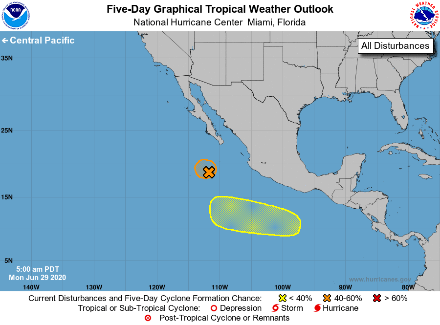
For the eastern North Pacific...east of 140 degrees west longitude:
1. Disorganized shower and thunderstorm activity has re-developed in
association with a broad area of low pressure located a few hundred
miles south-southwest of the southern tip of the Baja California
peninsula. The disturbance could still become a short-lived tropical
depression later today or tonight if the thunderstorm activity
becomes better organized before moving over colder waters Tuesday.
* Formation chance through 48 hours...medium...50 percent.
* Formation chance through 5 days...medium...50 percent.
2. An area of low pressure is forecast to form a few hundred miles
southwest of the Gulf of Tehuantepec later this week. Gradual
development of the system will be possible by the weekend while it
moves west-northwestward at 10 to 15 mph well south of Mexico.
* Formation chance through 48 hours...low...near 0 percent.
* Formation chance through 5 days...low...20 percent.
Forecaster Blake