ZCZC MIATWOEP ALL
TTAA00 KNHC DDHHMM
Tropical Weather Outlook
NWS National Hurricane Center Miami FL
500 AM PDT Sat Jun 27 2020
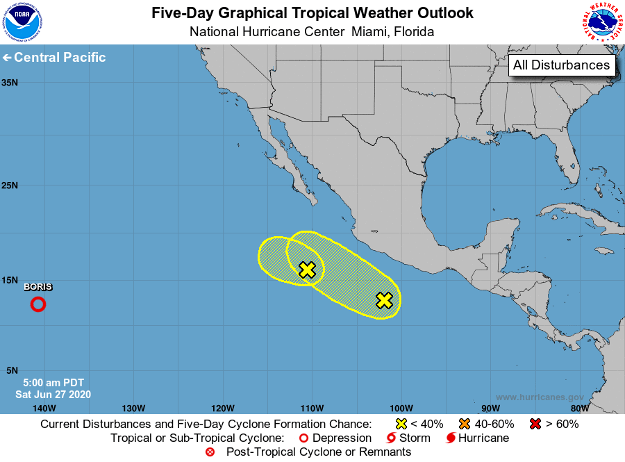
For the eastern North Pacific...east of 140 degrees west longitude:
1. A broad area of low pressure located several hundred miles south of
the southern tip of the Baja California peninsula continues to
produce disorganized showers and thunderstorms. Environmental
conditions are not conducive for development of this system while
it moves west-northwestward at about 10 mph during the next couple
of days.
* Formation chance through 48 hours...low...10 percent.
* Formation chance through 5 days...low...10 percent.
2. Another area of disorganized showers and thunderstorms is located
several hundred miles off the coast of southwestern Mexico. This
system is expected to move northwestward at about 15 mph, parallel
to the coast of Mexico, and some development is possible before it
reaches cooler waters in a couple of days.
* Formation chance through 48 hours...low...20 percent.
* Formation chance through 5 days...low...30 percent.
Forecaster Berg