ZCZC MIATWOEP ALL
TTAA00 KNHC DDHHMM
Tropical Weather Outlook
NWS National Hurricane Center Miami FL
1100 PM PDT Thu Jun 25 2020
For the eastern North Pacific...east of 140 degrees west longitude:
The National Hurricane Center is issuing advisories on Tropical
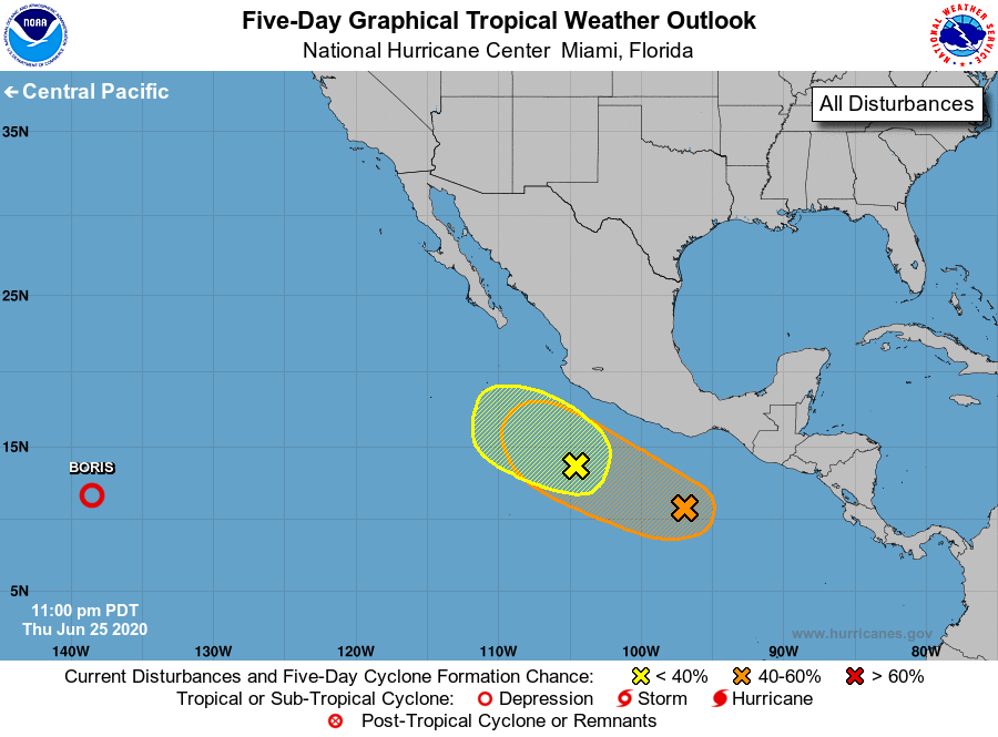
Storm Boris, located about 1200 miles east-southeast of Hilo,
Hawaii.
1. Showers and thunderstorms associated with a broad area of low
pressure located a few hundred miles south of the southwestern coast
of Mexico remain disorganized. Environmental conditions are
expected to become only marginally conducive for the development of
a tropical cyclone within the next couple of days while the system
moves west-northwestward parallel to the coast of Mexico.
* Formation chance through 48 hours...low...30 percent.
* Formation chance through 5 days...low...30 percent.
2. A large area of disturbed weather is located south of the Gulf of
Tehuantepec. Gradual development of this system is possible over
the next several days while it moves west-northwestward parallel to
the coast of Mexico.
* Formation chance through 48 hours...low...near 20 percent.
* Formation chance through 5 days...medium...40 percent.
Forecaster Stewart