ZCZC MIATWOEP ALL
TTAA00 KNHC DDHHMM
Tropical Weather Outlook
NWS National Hurricane Center Miami FL
500 PM PDT Mon Jun 22 2020
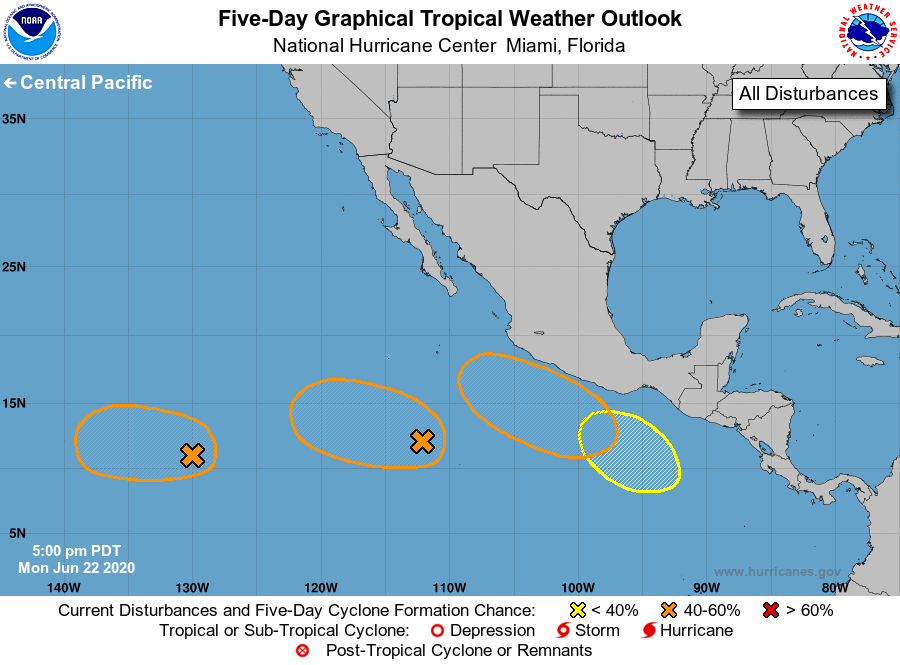
For the eastern North Pacific...east of 140 degrees west longitude:
1. An area of low pressure located more than 1500 miles southwest
of the southern tip of the Baja California peninsula has become a
little better organized during the past day. Environmental
conditions appear conducive for gradual development and this system
could become a tropical depression during the next few days while
it moves slowly westward.
* Formation chance through 48 hours...medium...50 percent.
* Formation chance through 5 days...medium...60 percent.
2. An elongated area of low pressure located several hundred miles
south-southwest of the southern tip of the Baja California peninsula
continues to produce showers and thunderstorms. Although this
system has changed little in organization since this morning,
gradual development is possible and a tropical depression could form
during the next two to three days. The disturbance is forecast to
move westward over cooler waters later this week, which should
inhibit further development.
* Formation chance through 48 hours...medium...50 percent.
* Formation chance through 5 days...medium...60 percent.
3. An area of disturbed weather is forecast to form south of the coast
of Mexico in a day or two. Some development is expected after
that time, and the system could become a tropical depression by late
this week as the disturbance moves west-northwestward parallel to
the coast of Mexico.
* Formation chance through 48 hours...low...near 0 percent.
* Formation chance through 5 days...medium...60 percent.
4. Another area of disturbed weather is forecast to form south of the
Gulf of Tehuantepec by late this week. Environmental conditions are
expected to be conducive for gradual development of this system
over the weekend as it moves west-northwestward parallel to the
coast of Mexico.
* Formation chance through 48 hours...low...near 0 percent.
* Formation chance through 5 days...low...20 percent.
Forecaster Zelinsky